Samangad-Fort

- Name of the Fort:
- Samangad
About Fort
- District:
- Kolhapur -Sindhudurg
- Route:
- Gandhinglaj – Bhadgao – Chenkuppi- Samangad
- Description:
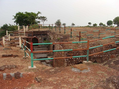
- Samangad Fort (Gadhinglaj) an isolated oval-topped hill three and a half miles south of Gadhinglaj (16° 10′ N; 74° 20′ E), has greatest height of 2,600 feet above the sea and greatest breadth of 260 feet. The hill top is surrounded by an eight feet high wall. Formerly it was well supplied with water from several rock-cut cisterns. For want of repairs for many years, the cisterns are not functioning at present (1957). In 1676, Samangad was thoroughly repaired by Sivaji. Though one of the smallest of Sivaji’s forts, Samangad was one of the strongest. In 1844, injudicious changes introduced by the minister Daji Pandit, by bringing their lands under the mamlatdar, enraged the Samangad garrison or Gadkaris who rebelled and shut the gates of the fort. On the 13th of October, 1844 the fort was taken by British troops under General Delamotte and dismantled. Since the disturbances of 1844 the mamlatdar’s head-quarters have been moved from Samangad to Gadhinglaj. [Details of the 1844 disturbance are given above under History.] The fort is now in a dilapidated condition.
Rangana fort has access from two sides. One from Patgaon in Kolhapur District and another from Narur in Kudal taluka of Sindhudurg district. The way from Kolhapur is simple but hells from deep and dense forest to pass through.
Rangana fort is situated at 95 km from Kolhapur at direct south side on the border of Kolhapur. The Kolhapur - Gargoti distance is 48 km. About 35 km from this place, is Patgaon. This was the old lane supplying essential girds for Rangana residents. S. T. Buses travel up to this place i.e. Patgaon. After Patgaon, Hanmanta Ghat stretched about 9 km. from Patgaon to Tambewadi. Tambewadi is small village at the edge of Ghat. This road from Patgaon to Tambewadi is very uneven. One walkway from Tabmewadi turns towards Rangana (ask to local villagers about road). This 8 km distance of this way through deep forest you have to cross three deep valleys, two three water bodies (one is a bit deep to pass vehicle through it) and not to forget about thick and dense forest. Thanks to an armature group from Kolhapur helped to show road till foot of Fort by putting signs of direction throughout the forest. Chikkewadi is a small habitat of 8 to 10 houses at 6-7 km from Tambewadi. Rangana's steep rise starts from Chikkewadi. After trekking shrub studded hill for almost 1 1\2 km first entrance of Rangana in form of broken remains show its presence.