- Name of the Fort:
- Gadgada
- Difficulty Level:
- Difficult
- Endurance Level:
- Difficult
About Fort
- Height of the Fort:
- 3156 ft
- Base Village:
- Ghargad Sankshi
- District:
- Nashik
- Region:
- Nashik
- Route:
- There is Vaitarana junction on Mumbai - Nashik Highway 163 Km from Mumbai (16 km from Ghoti) before the 18 Km of Nashik.2 km from the Junction there is "Vadivhire ". Fell out on the streets, it takes a village. At the traffic circle to the right hand or on the road 4 km "Gadgada SANGVI” of the village is the base of the fort. The erection of a command and the beginning of the road ' Bhavani Temple and Hanuman, Amboli mountain complex, Gadgada SANGVI ' has been written.Every hour there is ST bus to the village Vadivhire from Nashik, but the ST doesn’t drop you at Gadgada SANGVI village. Get down at Vadivhire,4 km walk takes you to Gadgada SANGVI. With private vehicle we can reach Gadgada SANGVI village.
- Distance from Pune:
- Description:
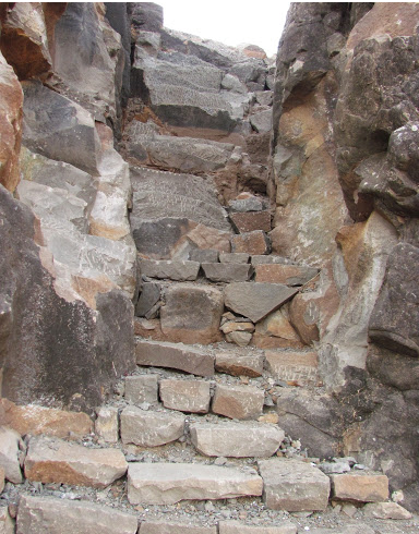
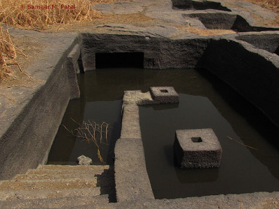
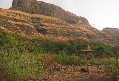
- Gadgada Fort, also known as Ghargad Fort, situated about 16kms from Ghoti in Nashik district of Maharashtra. Gadgad Sanghavi is a base village. A Hanuman temple or School in the village can be a place to stay for night. There is an Ashram situated at the base of Gadgada Fort. Nearby is a well with good potable water throughout the year. The route to the fort goes from a col to the left of the fort when seen from base village. When reached to the base of massive cliff, one can see steps carved in the rock which leads to the temple. Steps above this to the entrance door were blasted by British so the route is difficult. Make a traverse and climb from back side of the fort. From here too one has to climb a couple of rock patches to reach the fort. The patch is not very tough. One can rappel down from the entrance with the help of rope of approx 120 Feet and technical gears. There are 2 groups of water cisterns on top but no potable water. There is no shed on top.
Directions for Gadgada Fort (Ghargad), Nashik