Durg-Fort
About Fort
- Height of the Fort:
- 3855 feet
- Base Village:
- Amboli, Khutedhar
- Route:
- Pune - Junnar - Amboli
- Distance from Pune:
- 120 - 130 Km
- Description:
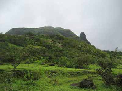
- Durg Fort - Take left from second bifurcation and you will reach a vast clearing(Either you take the first bifurcation or the second bifurcation they will meet at a single point), From here half an hour descent will take you to the stream. Crossing the stream, walking up and down towards village Hatvij one will reach a plateau. From here you will find a good path with Squarish, thickly forested Durg Fort on your right. On this Plateau itself, at southern base is durgadevi temple.
Turn right towards this temple (From stream it takes half an hour to reach the temple ). Follow the thin trail along the temple and one will reach the top of Durg Fort in another 15 mins.
One can descend down the fort and pinnacle through Khutedhar ghat. Return to the Durgadevi temple and set off to Hatvij. From Hatvij one can descend down towards Kokan through Khutedar ghat. It is quite a steep descent and an exposed one at some places. A bit difficult one must say.
However there are handholds all the way down to render it easy, with some wooden pegs where holds are inadequate. After good descent one will come across a stream and from here it will take around 1 hr to reach khuthedhar village. Total descent from Hatvij will take around 3 hrs. From Khutedhar one can reach Murbad through Jeeps. from Murbad one can get bus to Kalyan and other places.
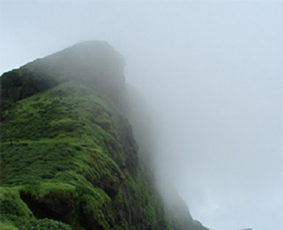
From Durg fort one can see entire Kokan. In north one can clearly see the main sahyadri crest line utill Naneghat which is natural dividing line between Desh plateau and Coastal Kokan. There are no prominent structures on the fort.